close
- Beranda arrow_forward_ios
- Profil arrow_forward_ios
- Layanan arrow_forward_ios
- Koleksi arrow_forward_ios
- Fasilitas arrow_forward_ios
- Berita arrow_forward_ios
- Informasi arrow_forward_ios
USU Official
arrow_forward_ios
MBKM
arrow_forward_ios
DIGILIB
arrow_forward_ios
Repositori USU
arrow_forward_ios
Resource Guide
arrow_forward_ios
-
ID expand_more

-
EN


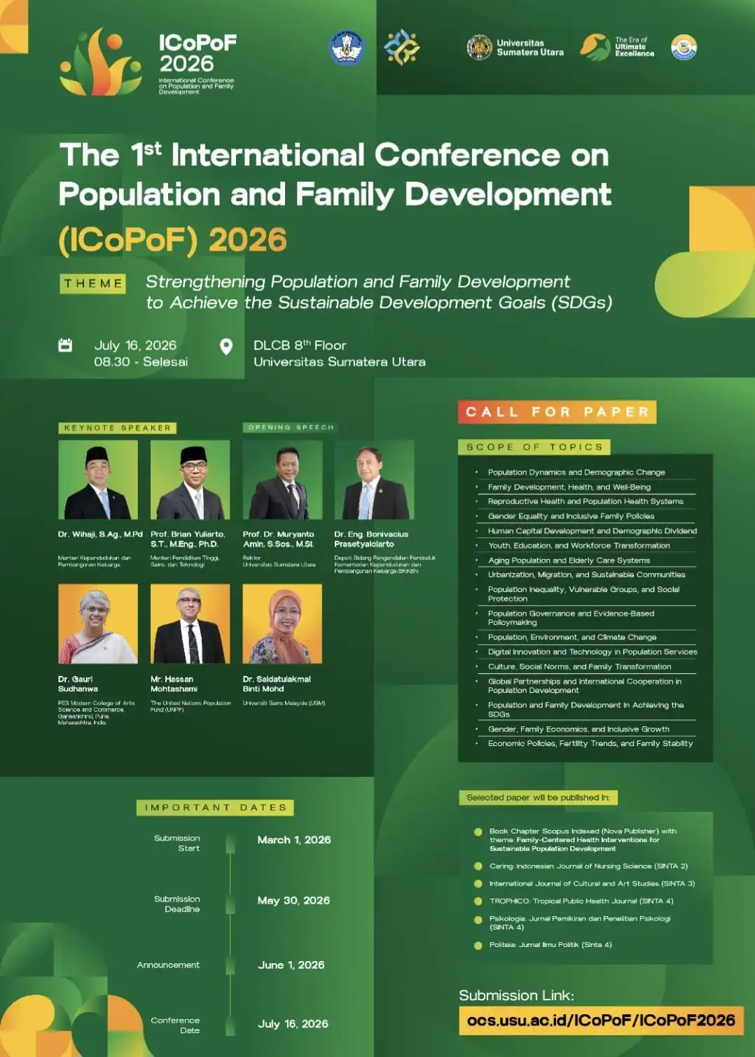
.webp)
.webp)